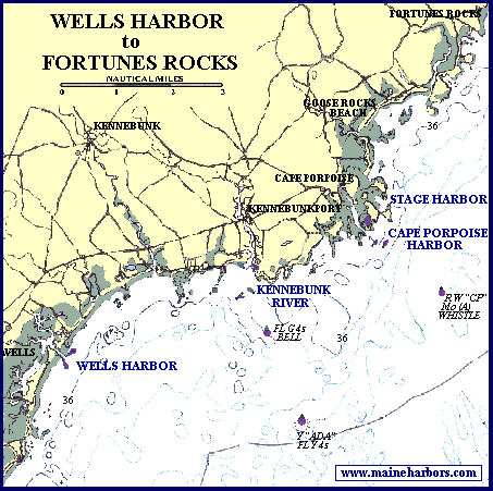
Wells Harbor - 38 k
Kennebunk River - 45 kwith navigation text
Cape Porpoise Harbor - 49 k
Stage Harbor - 34 k
1908 Kennebunkport - 20 k800 pixels wide by 923 tallbut it's fun to scroll around