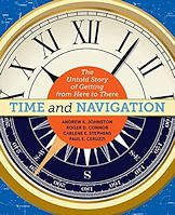
  Time and Navigation
The Untold Story of Getting from Here to There
Andrew K. Johnston, Roger D. Connor, Carlene E. Stephens, Paul E. Ceruzzi
Smithsonian Books, 2015, hc, 224pp, $29.95
Reviewing this book proves I'm a glutton for punishment. A lifelong math moron (since the long division brain freeze-up in the fourth grade) I have way more curiosity than aptitude in the realm of the hard sciences. Nevertheless, what I could understand of this text was fascinating and the charts and graphs in the book are clear and logical and artistically handsome. The photos are often spectacular. It is, without doubt a heavy book--(weighing in at a little over two pounds).
The first chapter explores the connection between time and place...which is as far as I got. Loved it, especially all the thought leaps of the early geographers. Roger Bacon proposed mapping the earth with latitude and longitude in 1265. He was way ahead of his times...for a European.
But the Europeans were way behind the inhabitants of the Western Pacific who had been exploring their watery world for tens of thousands of years. The Egyptians and other people of the Mediterranean Sea, the Persian Gulf and the Mediterranean Sea had been making long distant sea voyages two thousand years ago. They knew then that "heavenly bodies" provided a sense of direction.
Of course, politics played a major role. In Europe, by the 16th century cash prizes were awarded for finding and measuring longitude at sea. In the 17th century map makers knew only half of the earth's surface in any detail. By the 18th century, mariners were using sea clock astronomy to find longitude.
Medieval Europeans trade routes depended on personal knowledge...by keeping land in sight. They depended on the three "Ls--log, lead and lookout". The U.S. search for celestial navigation aids took a leap forward in 1843 when Sea Captain, Thomas Sumner (among several Harvard graduates involved in the challenge) discovered that he could calculate longitude based on estimate of latitude.
In separate sections, equally well illustrated, the book also covers navigation in the air, in space, the invention of satellite navigation and speculates on future adventures off planet. The last chapter, "Where Are We Headed" is the stuff of endless space, but I think I'll stick with my little sloop. This is great book, beautifully designed and illustrated and an incredible bargain at $29.95. (It's just a little Heavy!) Thanks, Smithsonian!
|